
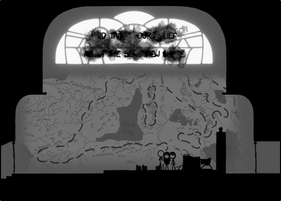
Map of Cuegan's area
Mapping the world around the sandcastle!
Long-distance unit = CueganNewpix (distance Cuegan travel on average during 1 Newpix)
Short-distance unit = Cueball (q)
Simplified ratio: 1 CueganNewpix = 10q
More frequently updated version of the map: http://edfel.atwebpages.com/Time-Map.php
Fork layout of the Pretty Neat River based on the manip: http://kieryn.com/xkcd-time/img/river-side.png
Geography poll: https://docs.google.com/forms/d/1kob2T4-V1Fly81u9paE78G8k50IDjSJnULIsETxWieg/viewform
Revelations[]
Beanish Map
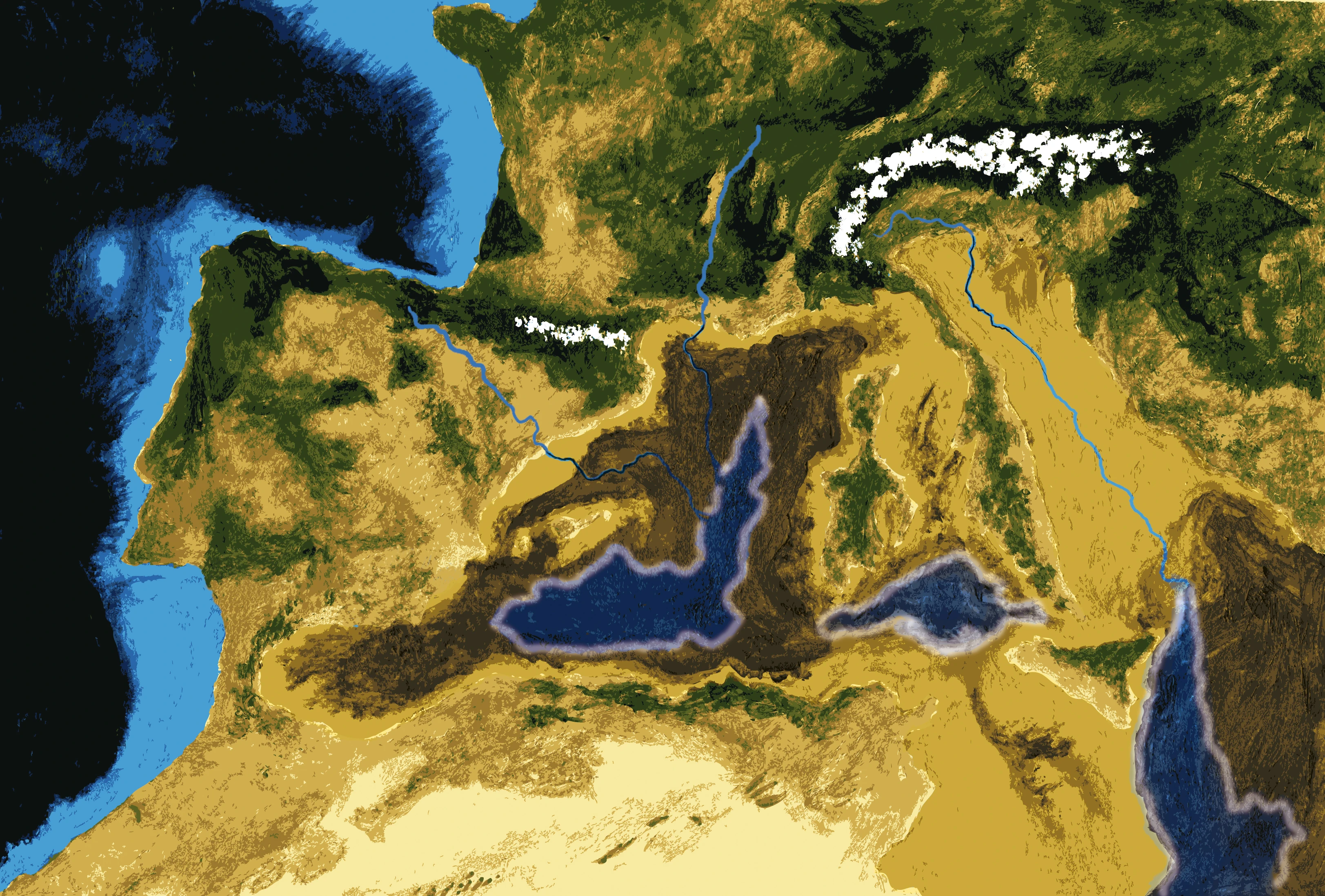
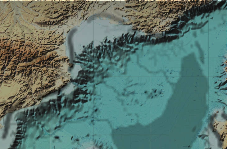
The Mediterranean Basin during the Messinian Salinity Crisis
With the Beanie Leader's revelations, we now know more about the location of the comic, which is apparently the Mediterranean Basin at some point in the future. The Mediterranean Sea has been dramatically depleted due to being cut off from the Atlantic Ocean for an unknown duration, creating a coastline roughly similar to the one that existed during the Messinian salinity crisis 5.96 to 5.33 million years ago, but it is on the verge of being replenished by the ocean in a rapid flood.
From matching the Beanie Leader's map to current maps, the small river is the continuation of the river Ter in Spain. The river to the West is the continuation of the rivers Llobregat and Ebro. The bigger "neat" river to the East which they follow to the Beanie castle is the continuation of the river Rhône in France. The Beanie castle is the Château d’If on a small island off the coast of Marseille, France. When they notice that "the mountains don't go back down on the other side" in frame 2584, they've reached the plateau that is the Gulf of Lion. The mountain range to the West of the small sea forms the Balearic Islands. The location of the sandcastle is 275km South of Marseille, 230km West of Sardinia and 130km North-East of Menorca.
Overlay of the beanies map with current mediterranean barymethic map. (Thanks to anabatica!)